
Naneghat is a mountain pass in the Western Ghats range near Junnar in Pune district of Maharashtra, India. During the reign of the Satavahana (200 BCE–190 CE), the pass was extensively used as a trade route between Kalyan and Junnar. Literally, the name nane means "coin" and ghat means "pass". The name is given because this path was used as a tollbooth to collect toll from traders crossing the hills.
History
It's the one of the ancient trade routes, existing right from the Satvahanas, which ghats and was in extensive use to transport goods arriving at the Junnar which was then a flourished market place. Hundreds's of years gone but still villagers at the ghat area use this pass to reach konkan. It reflects how the emperors use to skillfully choose locations
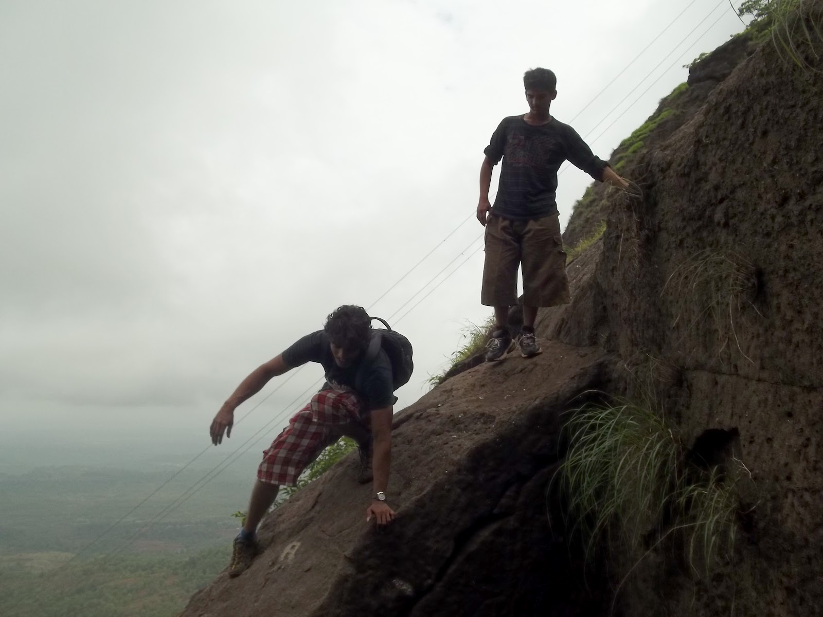
Naneghat trek is one of the best Monsoon treks. Naneghat speaks very old history which is hardly clearly known to commons. This ignored pass once served a vital trade route between Kalyan and Junnar. Naneghat trek is simple and enjoyable. Way is clearly marked and passes through dense teakwood forests. Climbing from the forest you reach to the base of ‘Nanacha Angatha’, which is pinnacle of Naneghat plateau.
From this base, a 2 meter wide pass connects to the actual plateau. This pass called as ‘Naneghatachi NaLi’ ( ) has been carved and cut in stones by emperors of that time. This 60 meter long pass takes you to the Naneghat plateau.
Naneghat Caves
The cave was artificially made and acted as a resting point for this Naneghat trade route long time back. It was currently maintained by the government. There is also an village which is arond 5 kms away.
Fascinating Spots :
The first thing we can see after reaching Naneghat is the spacious cave of Naneghat. The ancient carvings, which are seen on the walls of the cave, remind us of the Satvaahan period. Here we find inscriptions in Brahmi script all over the cave. These indicate the magnificent era of the Satvaahans and their generosity. These inscriptions are gradually being destroyed, and only a part of it is remaining. The inscriptions are very precious, and are undergoing destruction due to the negligence of Archeology.
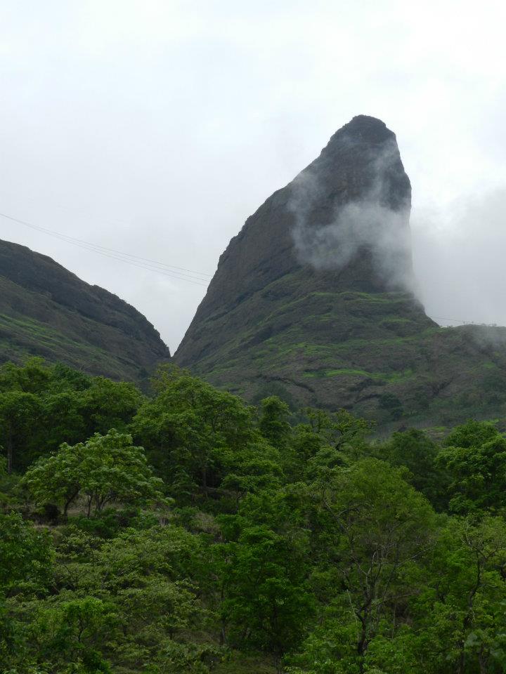
The widely spread plateau of Naneghat is an astonishment. To the left the steps besides the cave lead us to the plateau and going to the right lead us to Nana's thumb. After climbing all the way to the bottom of the thumb, when we climb the stairs, we do not expect a big plateau. Thus this route leads directly to a higher altitude quickly, unlike Malshej Ghat, which goes all around the mountains. Ate the entrance to the Ghat is a big stone-made vessel like thing, in which coins as toll were put.
Ways To Reach :
From Kalyan :
Naneghat lies to Northwest of Junnar at 27 km. State Transport buses (S.T.) plying regularly from Kalyan to Ahmednagar help us to reach Vaishakhare. From Vaishakhare at about 4 km a diversion towards Naneghat originates. A stone on which is written Malshej 29 indicates the diversion towards Naneghat. A thumb shaped cliff that can be viewed from the highway is the topmost point of Naneghat & is also known as Nana's thumb. Today there is board that specifies diversion to Naneghat.
From Junnar :
The next way, if we want to go from Poona or Junnar to Naneghat, is to board the Junnar-Ghatghar S.T.bus & to reach Ghatghar. A half an hour run take us to Naneghat. Private buses can reach up to the mouth of the Ghat.
Accommodation Facility :
Nearly 50 persons can be accommodated at a time easily in the cave, which is the only place for accommodation.
History
It's the one of the ancient trade routes, existing right from the Satvahanas, which ghats and was in extensive use to transport goods arriving at the Junnar which was then a flourished market place. Hundreds's of years gone but still villagers at the ghat area use this pass to reach konkan. It reflects how the emperors use to skillfully choose locations
Naneghat trek is one of the best Monsoon treks. Naneghat speaks very old history which is hardly clearly known to commons. This ignored pass once served a vital trade route between Kalyan and Junnar. Naneghat trek is simple and enjoyable. Way is clearly marked and passes through dense teakwood forests. Climbing from the forest you reach to the base of ‘Nanacha Angatha’, which is pinnacle of Naneghat plateau.
From this base, a 2 meter wide pass connects to the actual plateau. This pass called as ‘Naneghatachi NaLi’ ( ) has been carved and cut in stones by emperors of that time. This 60 meter long pass takes you to the Naneghat plateau.
Naneghat Caves
The cave was artificially made and acted as a resting point for this Naneghat trade route long time back. It was currently maintained by the government. There is also an village which is arond 5 kms away.
Fascinating Spots :
The first thing we can see after reaching Naneghat is the spacious cave of Naneghat. The ancient carvings, which are seen on the walls of the cave, remind us of the Satvaahan period. Here we find inscriptions in Brahmi script all over the cave. These indicate the magnificent era of the Satvaahans and their generosity. These inscriptions are gradually being destroyed, and only a part of it is remaining. The inscriptions are very precious, and are undergoing destruction due to the negligence of Archeology.
The widely spread plateau of Naneghat is an astonishment. To the left the steps besides the cave lead us to the plateau and going to the right lead us to Nana's thumb. After climbing all the way to the bottom of the thumb, when we climb the stairs, we do not expect a big plateau. Thus this route leads directly to a higher altitude quickly, unlike Malshej Ghat, which goes all around the mountains. Ate the entrance to the Ghat is a big stone-made vessel like thing, in which coins as toll were put.
Ways To Reach :
From Kalyan :
Naneghat lies to Northwest of Junnar at 27 km. State Transport buses (S.T.) plying regularly from Kalyan to Ahmednagar help us to reach Vaishakhare. From Vaishakhare at about 4 km a diversion towards Naneghat originates. A stone on which is written Malshej 29 indicates the diversion towards Naneghat. A thumb shaped cliff that can be viewed from the highway is the topmost point of Naneghat & is also known as Nana's thumb. Today there is board that specifies diversion to Naneghat.
From Junnar :
The next way, if we want to go from Poona or Junnar to Naneghat, is to board the Junnar-Ghatghar S.T.bus & to reach Ghatghar. A half an hour run take us to Naneghat. Private buses can reach up to the mouth of the Ghat.
Accommodation Facility :
Nearly 50 persons can be accommodated at a time easily in the cave, which is the only place for accommodation.


No comments:
Post a Comment